Ouachita River Basin
Water Control Report
VICKSBURG DISTRICT
Last Updated APRIL 26, 2024 @ 03:30 |
|
Station |
Flood Stage |
Date/Time |
Stage |
Elev |
24 hour change |
Flow
CFS |
|
Station |
Date/Time |
Stage |
24 hour change |
Head |
|
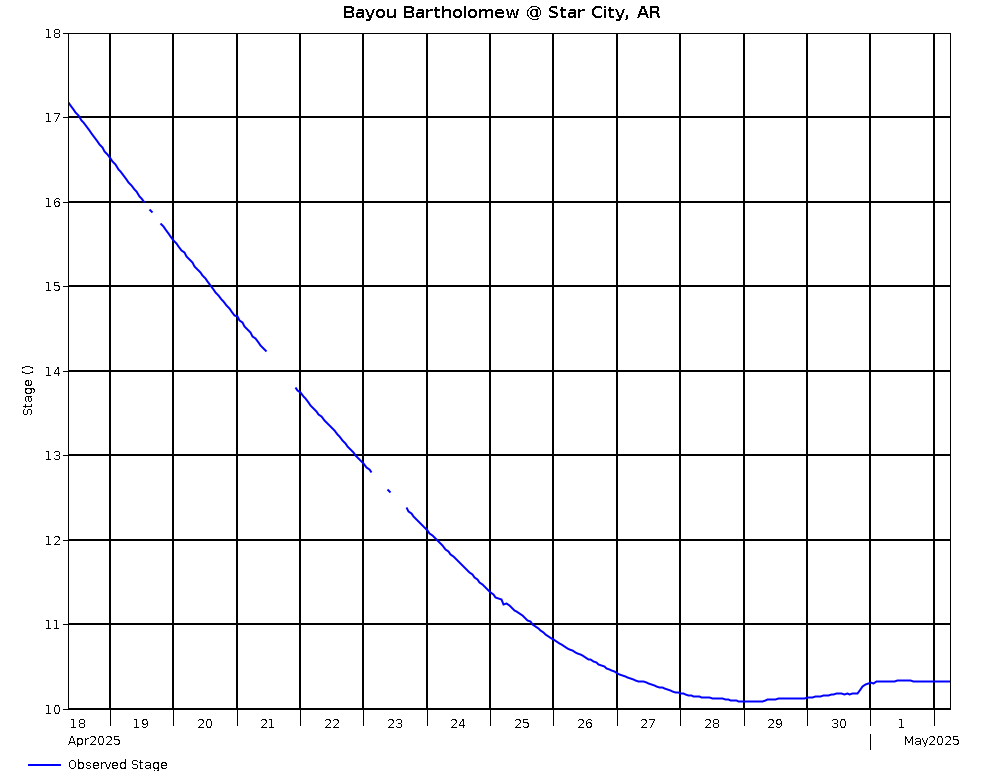
Bayou Bartholomew @ Star City, AR |
|
4/26 @ 02:00 |
10.95 |
164.20 |
-.71 |
|
|
Ouachita River @ Blakely Mt. Dam, AR |
4/26 @ 02:00 |
576.67 |
-.10 |
|
|
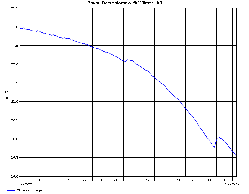
Bayou Bartholomew @ Wilmot, AR |
|
4/26 @ 02:00 |
24.27 |
109.44 |
-.07 |
|
|
Caddo River @ Degray Dam, AR |
4/26 @ 02:00 |
404.42 |
-.08 |
|
|
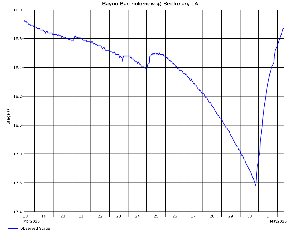
Bayou Bartholomew @ Beekman, LA |
15.0 |
4/26 @ 02:00 |
22.98 |
93.58 |
-.40 |
|
|
Little Missouri River @ Narrows Dam, AR |
4/26 @ 02:00 |
538.85 |
.03 |
|
|
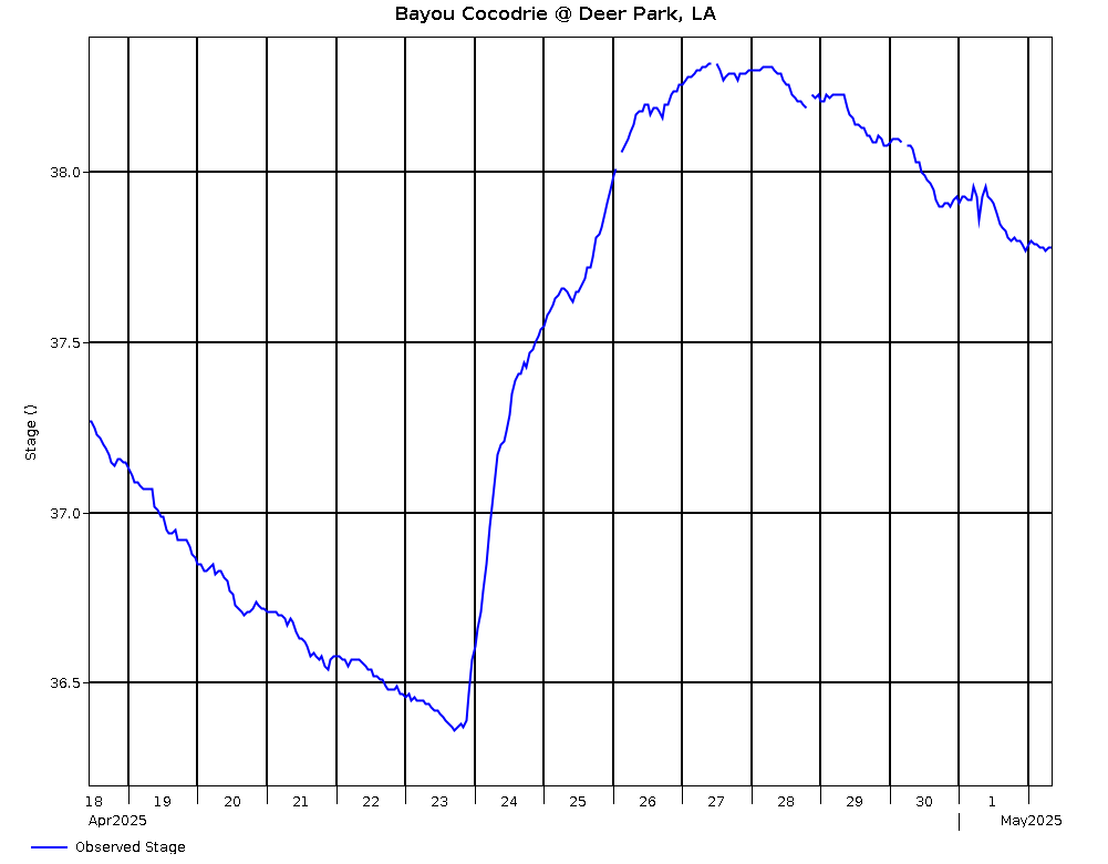
Bayou Cocodrie @ Deer Park Monterey, LA |
50.0 |
4/26 @ 02:00 |
37.38 |
37.38 |
-.32 |
|
|
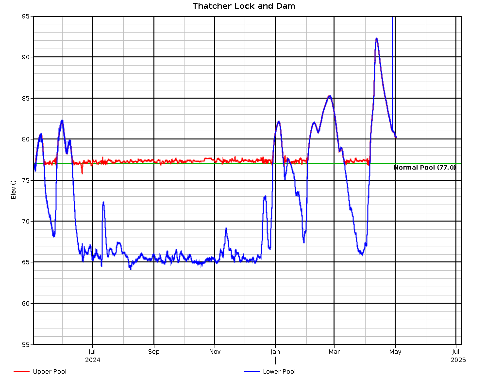
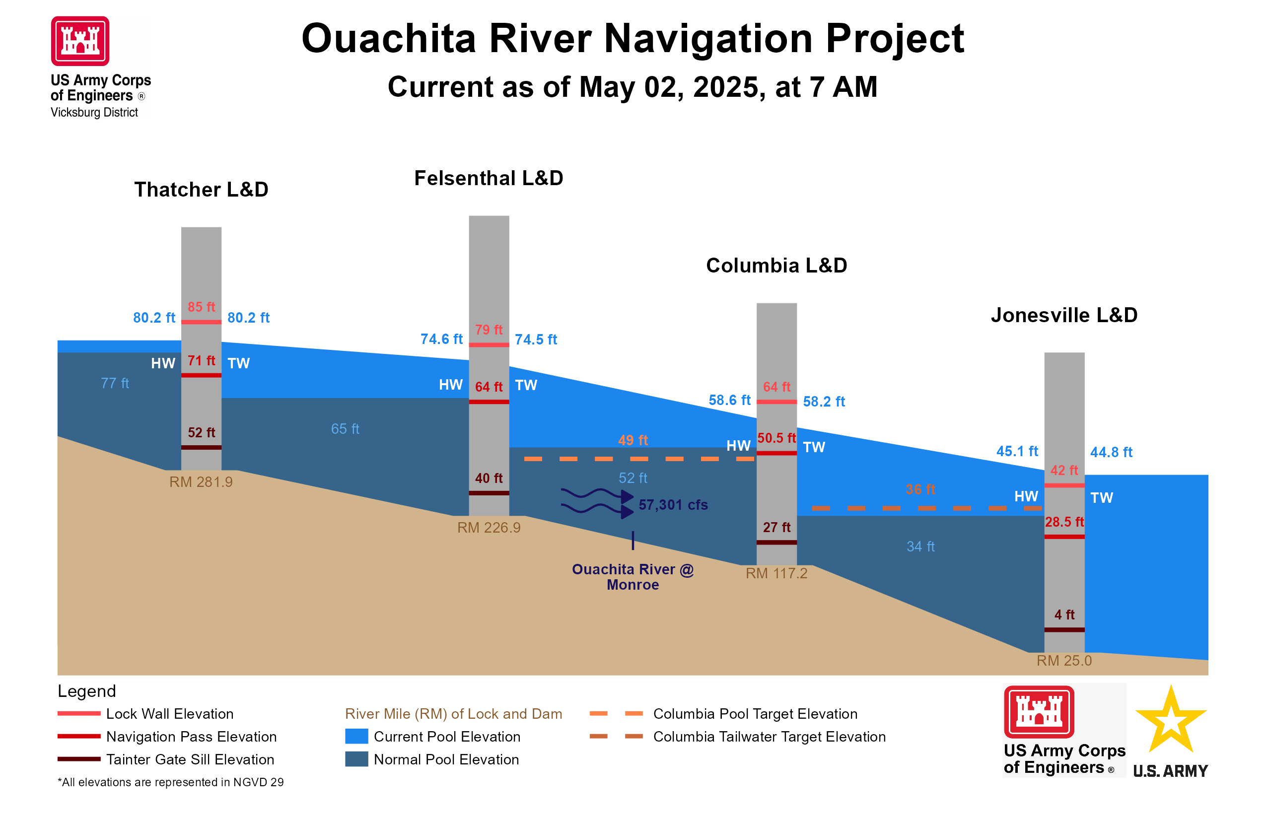
Ouachita River @ Thatcher L&D Upper |
4/26 @ 02:30 |
76.76 |
-1.19 |
.24 |
|
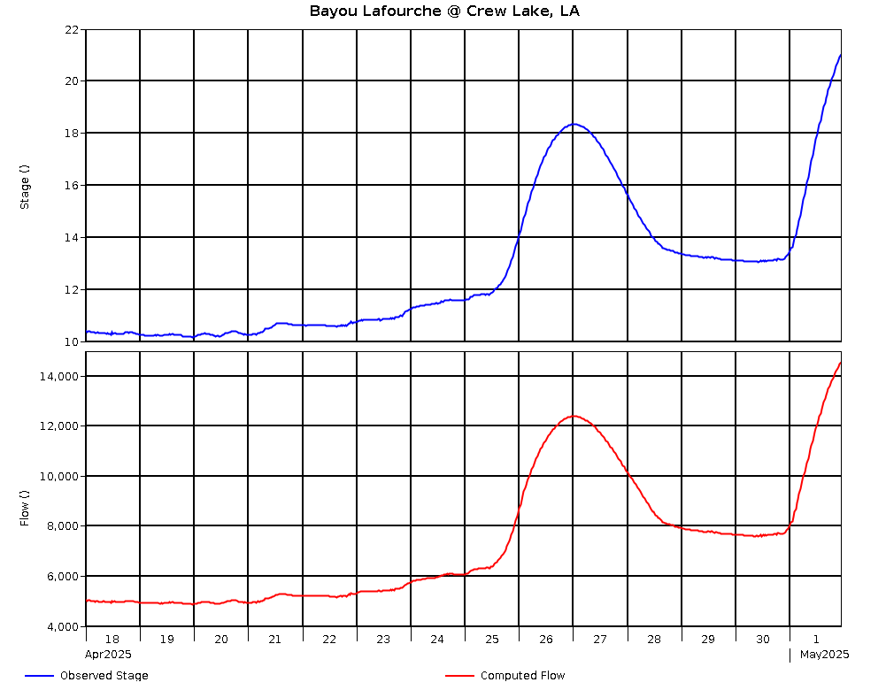
Bayou Lafourche @ Crew Lake, LA (USGS) |
22.0 |
4/26 @ 02:30 |
23.82 |
60.90 |
-1.63 |
17,127 |
|
Ouachita River @ Thatcher L&D Lower |
4/26 @ 02:30 |
76.52 |
-.92 |
|
|
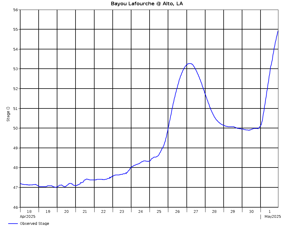
Bayou Lafourche @ Alto, LA (USGS) |
|
4/26 @ 02:30 |
59.53 |
59.53 |
-.88 |
|
|
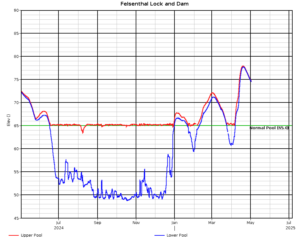
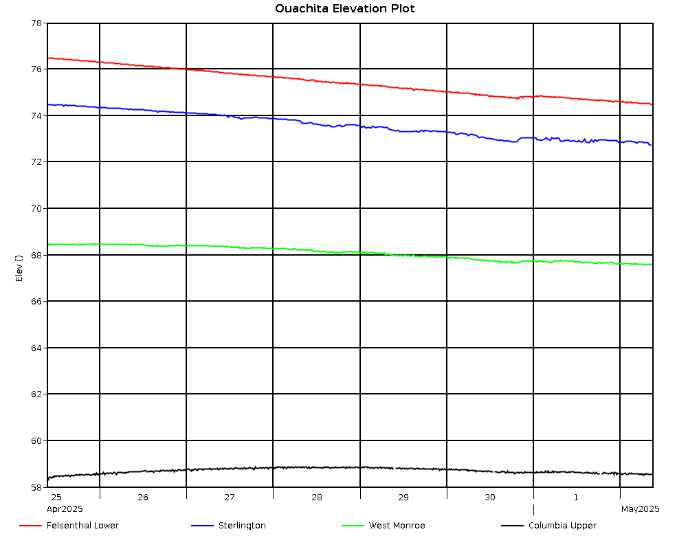
Ouachita River @ Felsenthal L&D Upper |
4/26 @ 02:45 |
73.11 |
-.27 |
.16 |
|
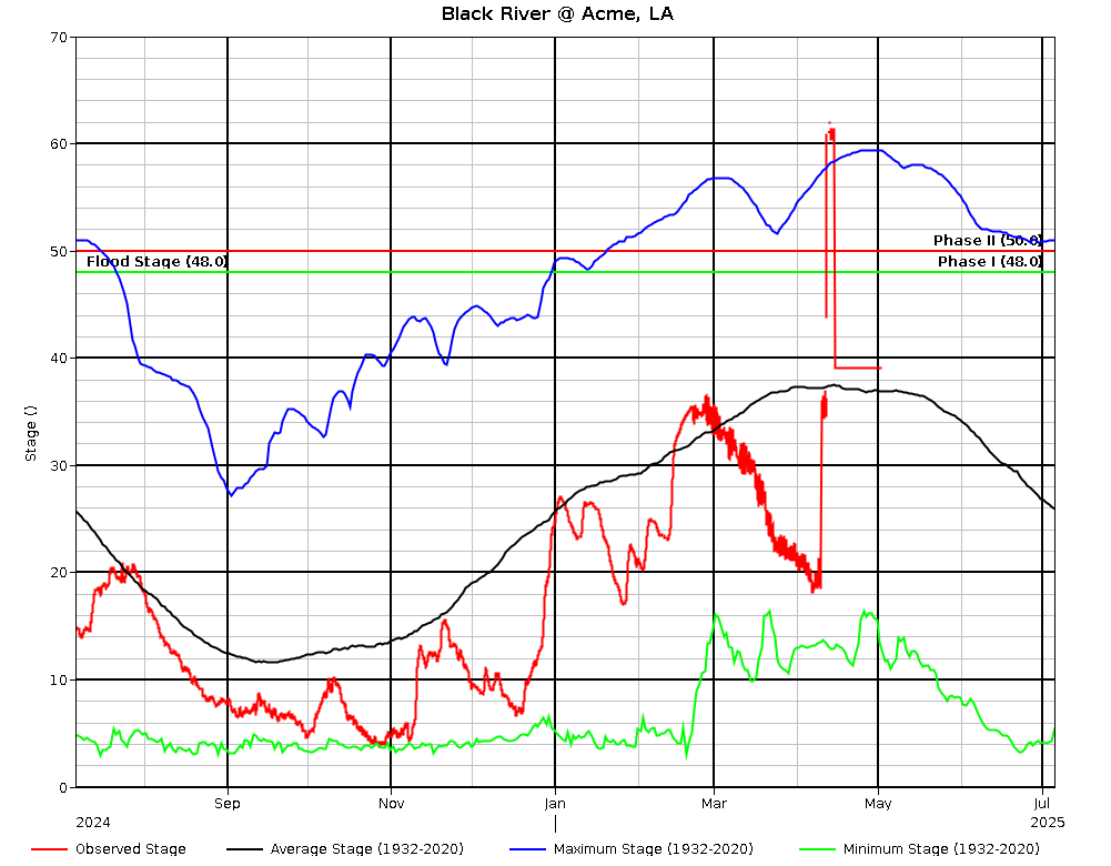
Black River @ Acme, LA |
48.0 |
4/26 @ 02:00 |
34.92 |
35.60 |
-.72 |
|
|
Ouachita River @ Felsenthal L&D Lower |
4/26 @ 02:45 |
72.95 |
-.24 |
|
|
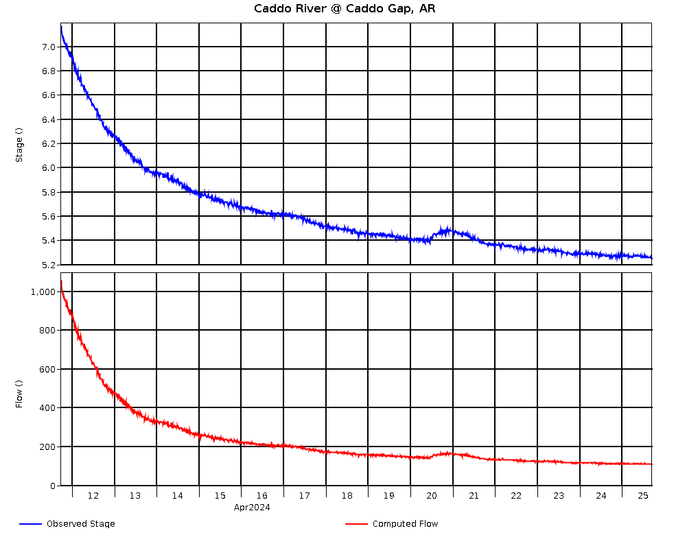
Caddo River @ Caddo Gap, AR (USGS) |
|
4/26 @ 02:45 |
5.26 |
617.26 |
-.01 |
111 |
|
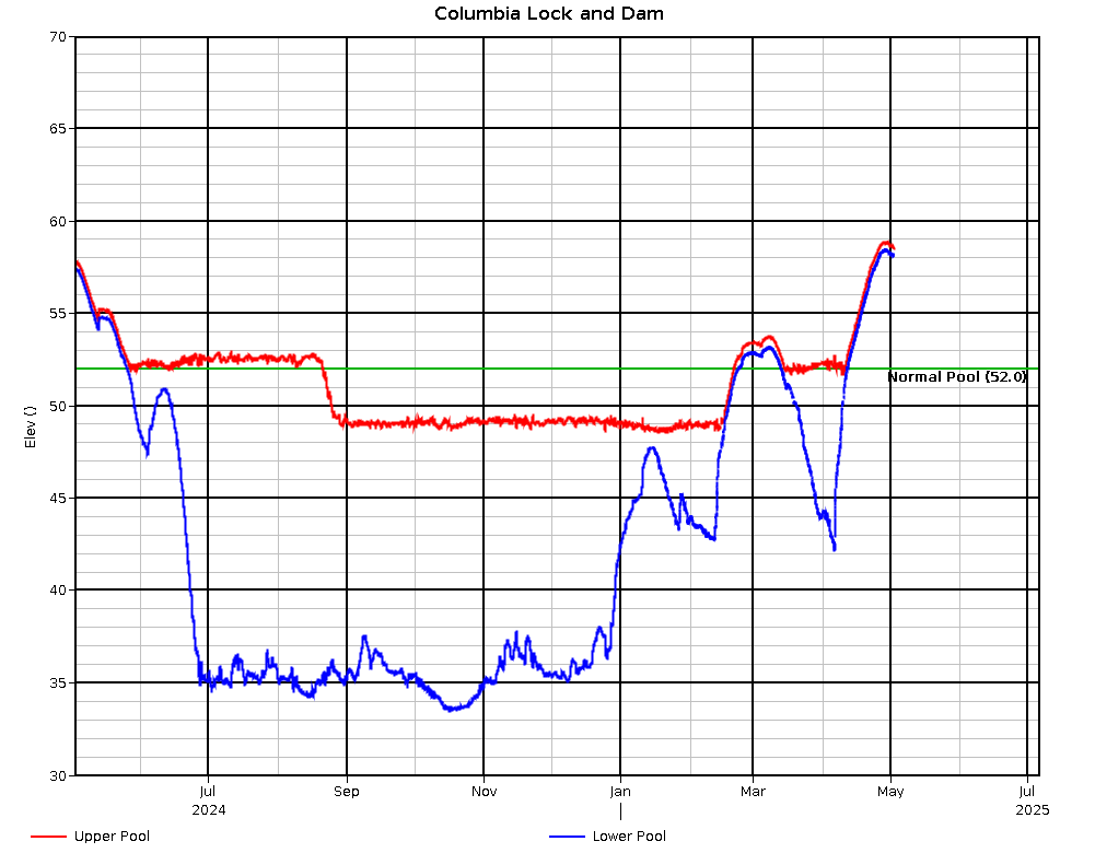
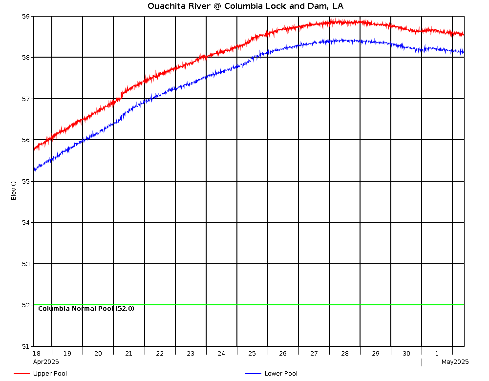
Ouachita River @ Columbia L&D Upper |
4/26 @ 02:45 |
57.96 |
-.07 |
.37 |
|
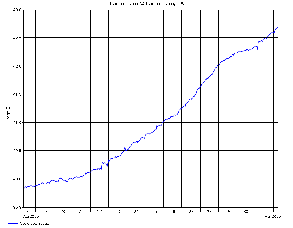
Larto Lake @ Larto Lake, LA |
|
4/26 @ 02:00 |
40.07 |
40.07 |
-.35 |
|
|
Ouachita River @ Columbia L&D Lower |
4/26 @ 02:30 |
57.59 |
-.03 |
|
|
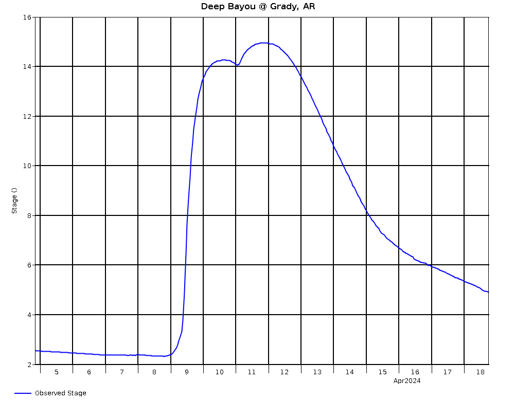
Deep Bayou @ Grady, AR |
|
4/26 @ 02:00 |
2.63 |
165.13 |
-.09 |
|
|
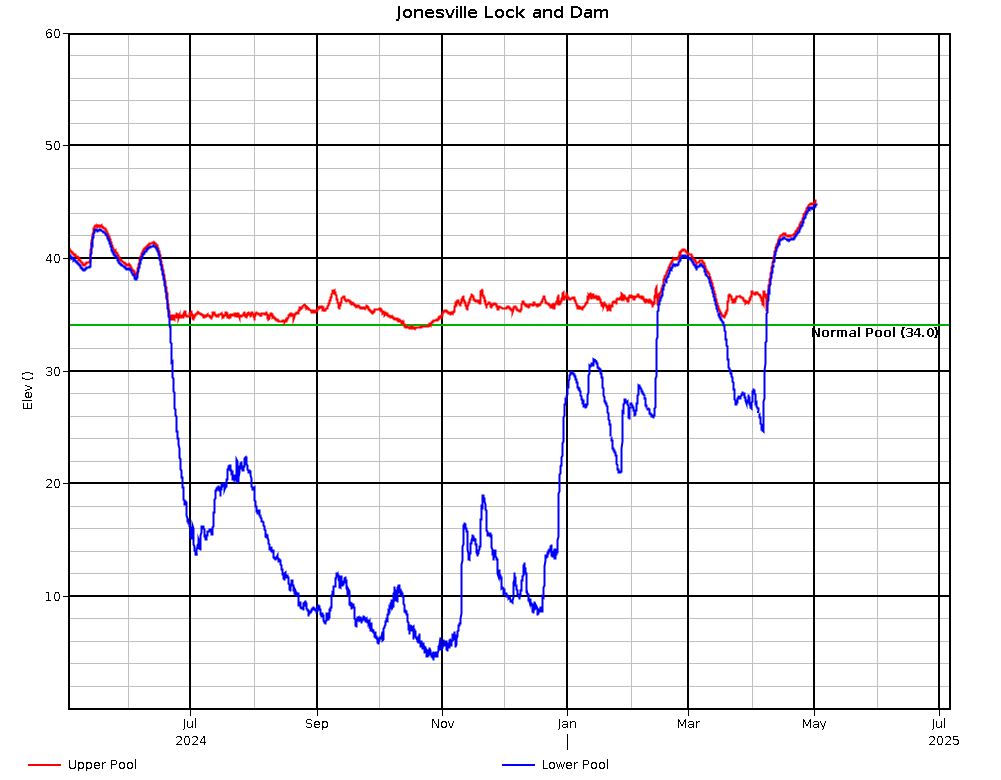
Black River @ Jonesville L&D Upper |
4/26 @ 02:00 |
41.76 |
-.41 |
.51 |
|
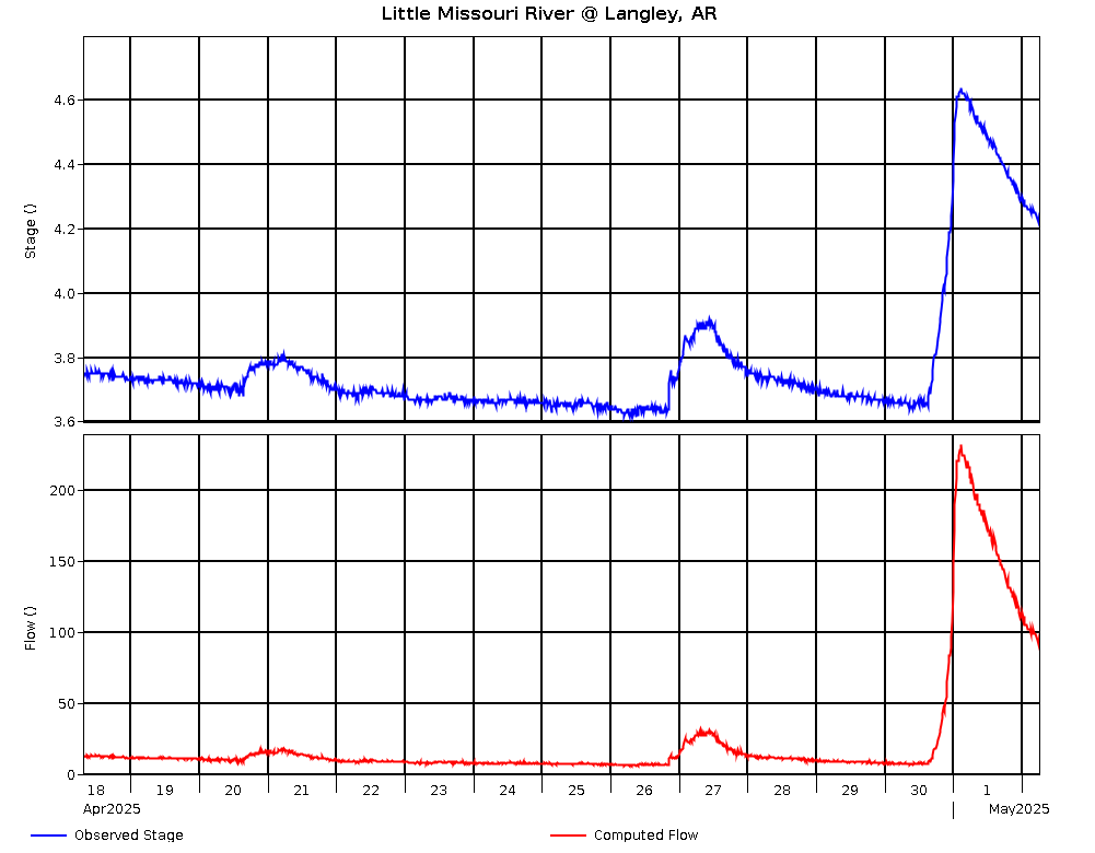
Little Missouri River @ Langley, AR (USGS) |
|
4/26 @ 03:00 |
3.57 |
730.57 |
-.02 |
61 |
|
Black River @ Jonesville L&D Lower |
4/26 @ 02:00 |
41.25 |
-.39 |
|
|
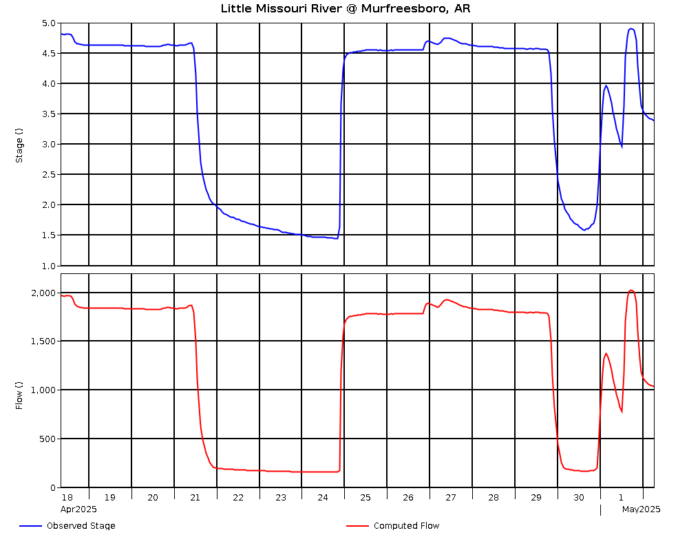
Little Missouri River @ Murfreesboro, AR |
17.0 |
4/26 @ 02:00 |
1.40 |
325.68 |
-.04 |
152 |
|
Black River @ Jonesville L&D Lock |
4/26 @ 02:00> |
12.82 |
.01 |
|
|
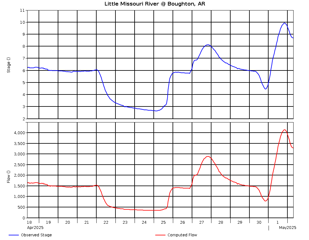
Little Missouri River @ Boughton, AR |
20.0 |
4/26 @ 02:00 |
2.42 |
184.55 |
-.12 |
313 |
|
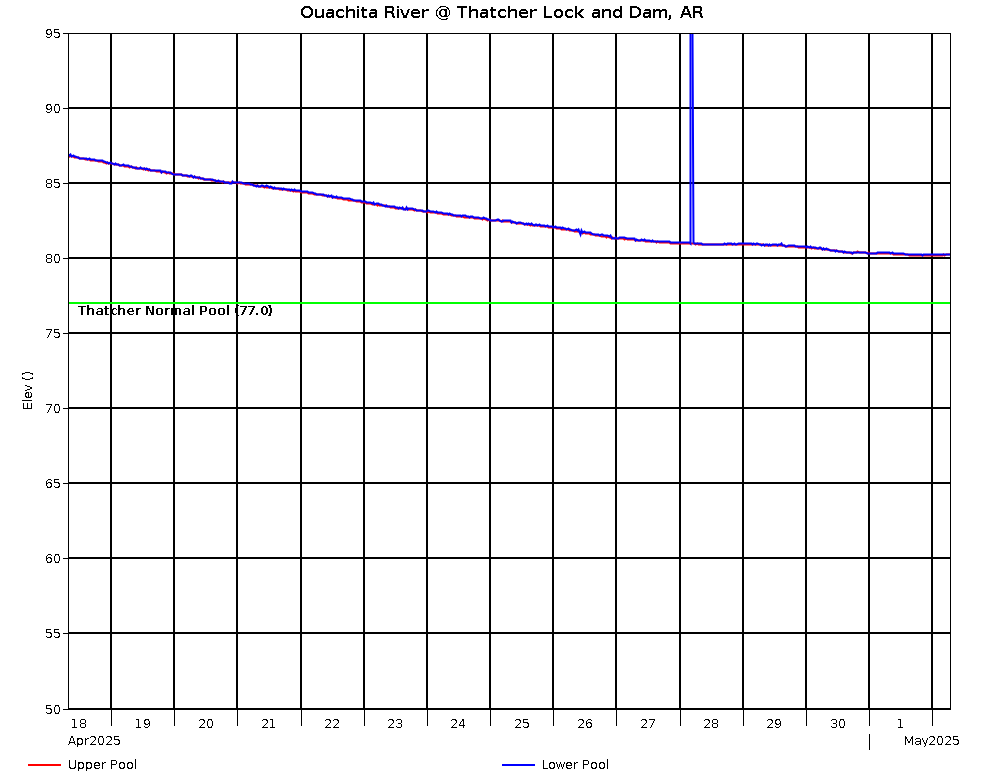
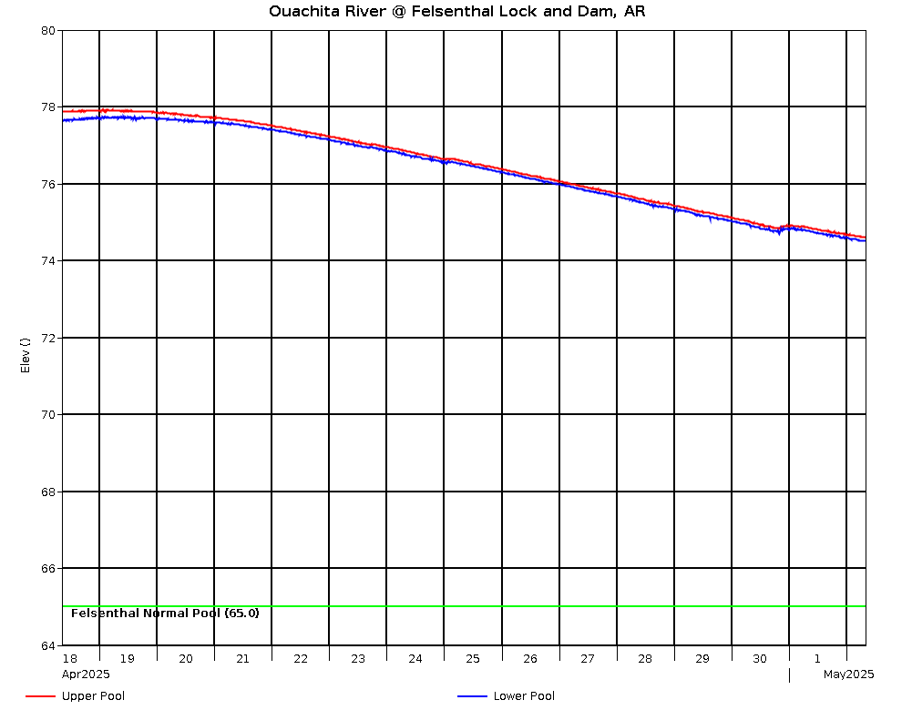
Ouachita Lock and Dam Profile |
Ouachita River Elevation Plot |
|
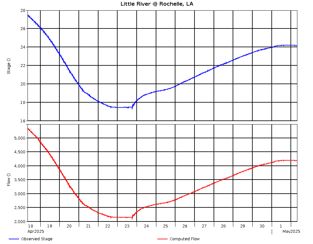
Little River @ Rochelle, LA (USGS) |
32.0 |
4/26 @ 02:30 |
22.84 |
47.63 |
-2.69 |
3,242 |
|
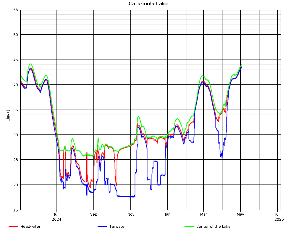
Catahoula Lake @ Center of the Lake, LA |
4/26 @ 01:00 |
43.58 |
-.30 |
|
|
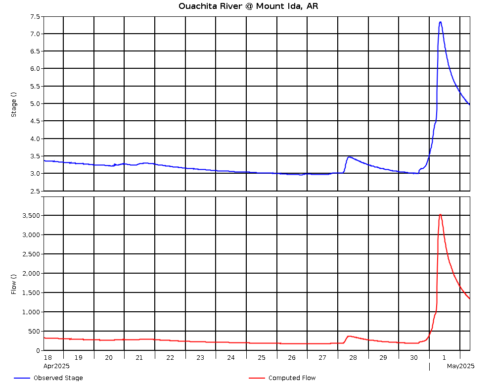
Ouachita River @ Mount Ida, AR (USGS) |
22.0 |
4/26 @ 02:45 |
3.09 |
690.09 |
0.00 |
235 |
|
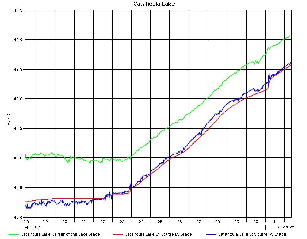
Catahoula Lake Control Structure L.S. |
4/26 @ 02:30 |
42.73 |
-.31 |
|
|
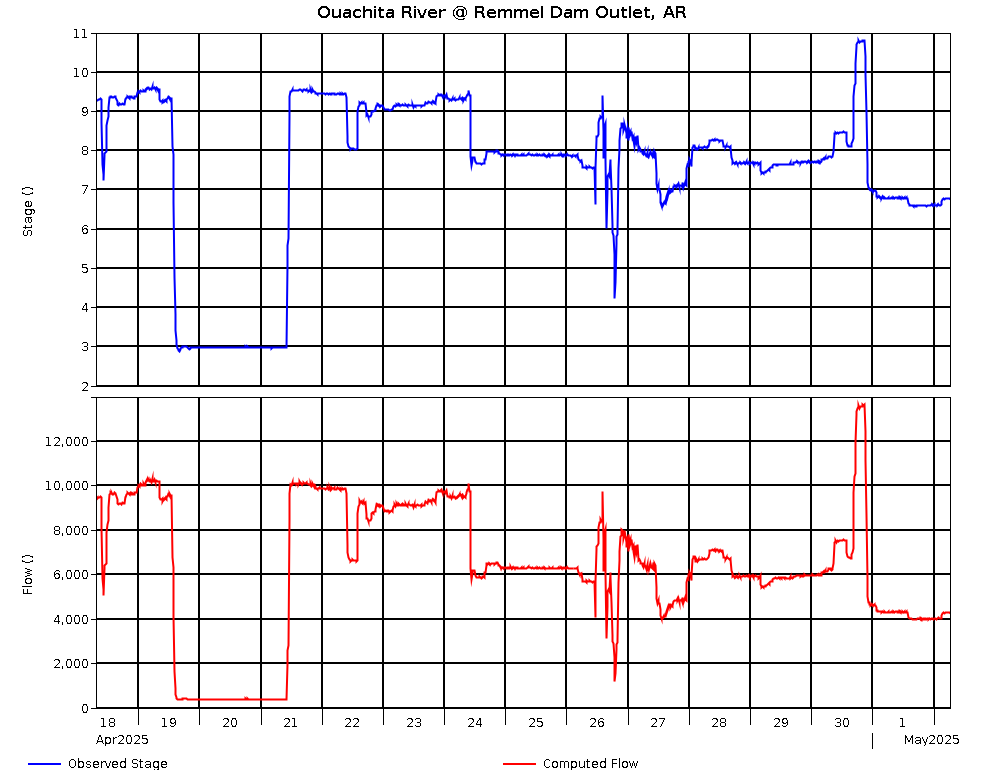
Ouachita River @ Remmel Dam, AR (USGS) |
|
4/26 @ 03:00 |
3.15 |
251.31 |
0.00 |
463 |
|
Catahoula Lake Control Structure R.S. |
4/26 @ 02:30 |
42.31 |
-.35 |
|
|
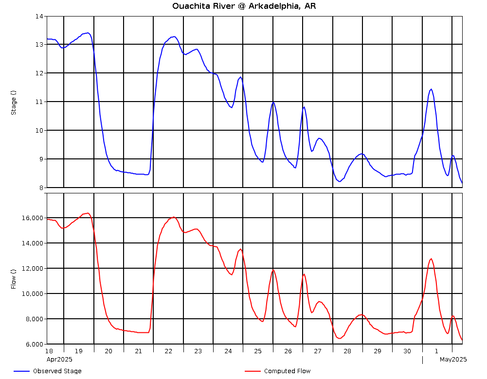
Ouachita River @ Arkadelphia, AR |
17.0 |
4/26 @ 02:00 |
5.22 |
165.52 |
.12 |
2,220 |
|
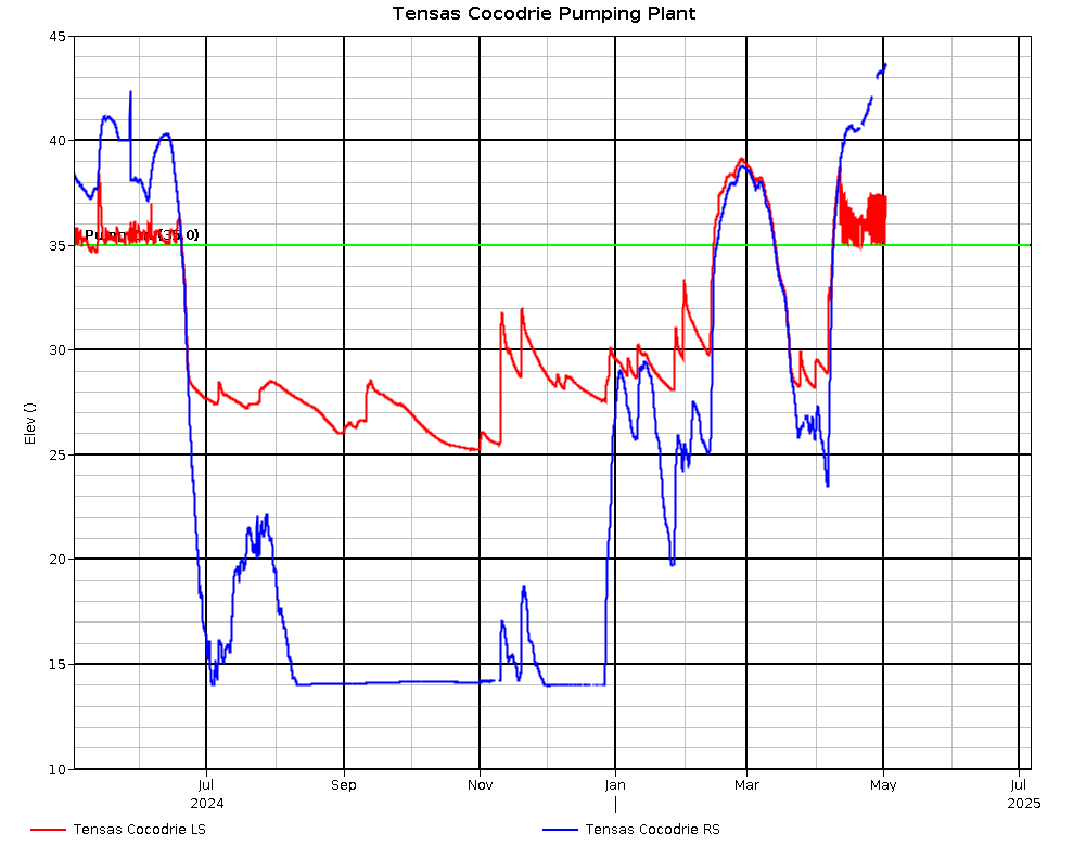
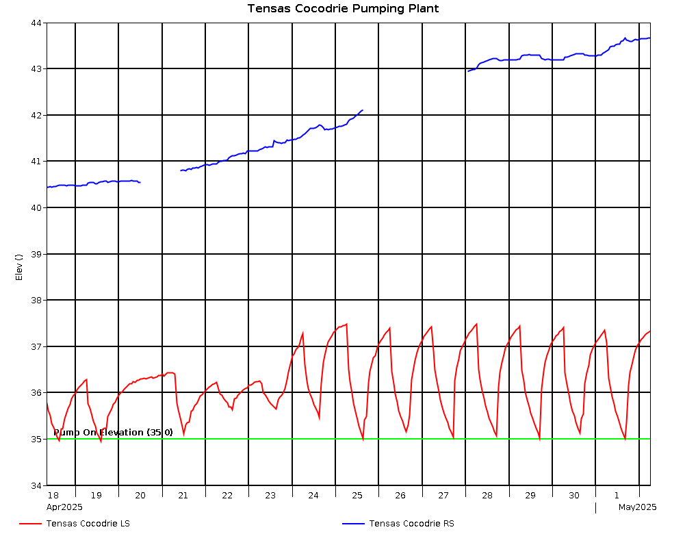
Tensas Cocodrie Pumping Plant L.S. |
4/26 @ 02:00 |
35.10 |
-.29 |
|
|
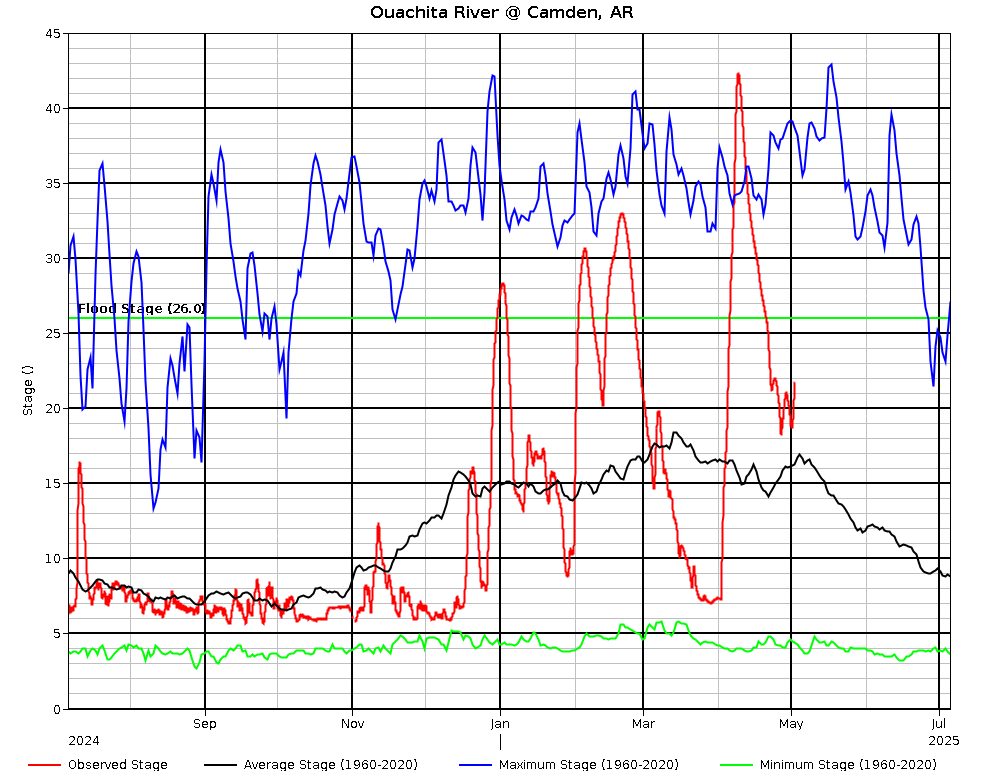
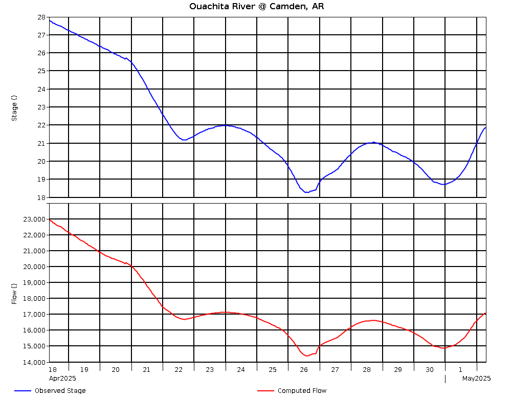
Ouachita River @ Camden, AR |
26.0 |
4/26 @ 02:00 |
9.89 |
81.58 |
-1.27 |
4,634 |
|
Tensas Cocodrie Pumping Plant R.S. |
4/26 @ 02:00 |
38.91 |
-.53 |
|
|
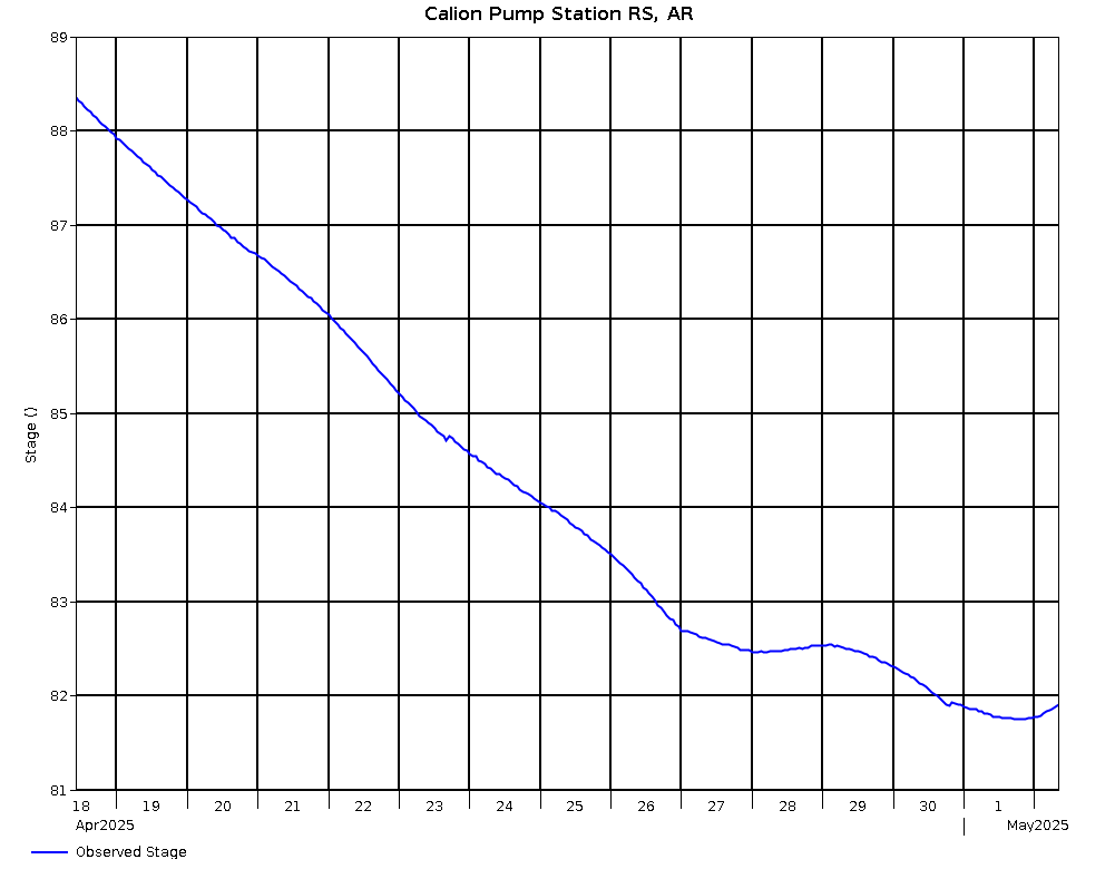
Ouachita River @ Calion Pumping Station RS, AR |
|
4/26 @ 02:00 |
77.85 |
77.85 |
-1.32 |
|
|
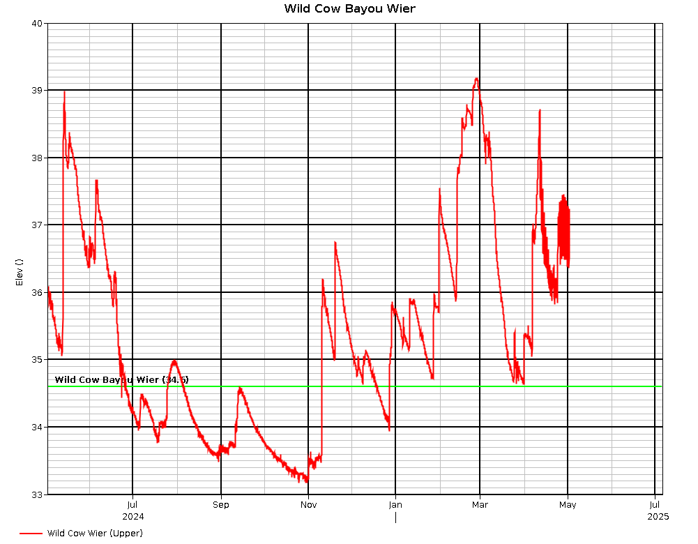
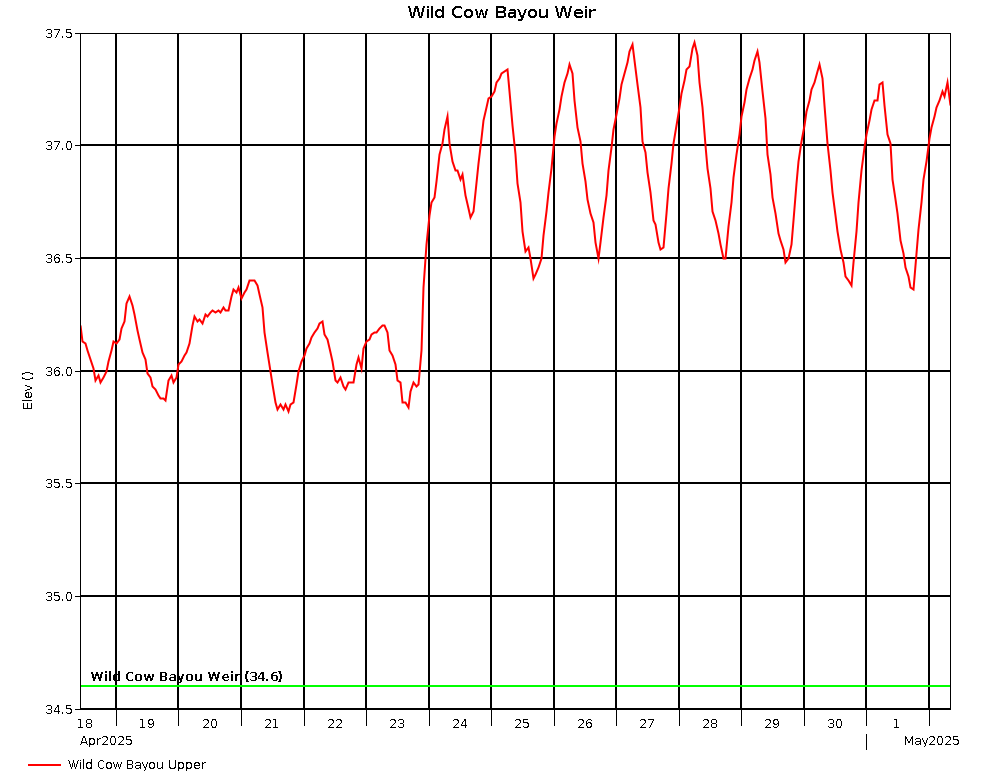
Wild Cow Bayou Structure L.S. |
4/26 @ 02:00 |
35.97 |
-.23 |
|
|
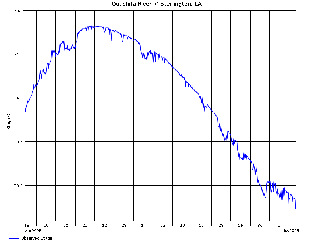
Ouachita River @ Sterlington, LA (USGS) |
|
4/26 @ 02:30 |
71.44 |
71.44 |
-.24 |
|
|
|
|
|
|
|
|
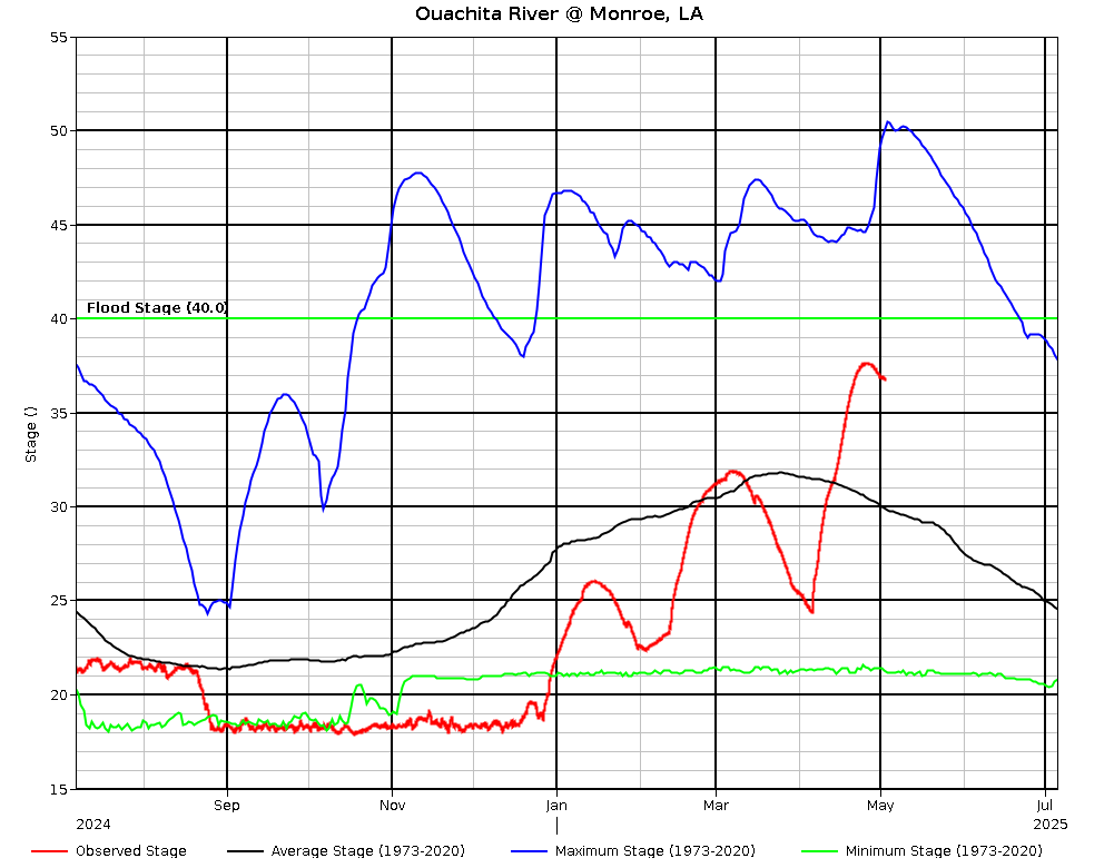
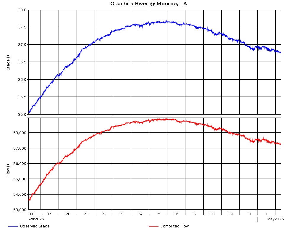
Ouachita River @ Monroe, LA
(USGS) |
40.0 |
4/26 @ 03:00 |
35.48 |
66.29 |
-.09 |
54,604 |
|
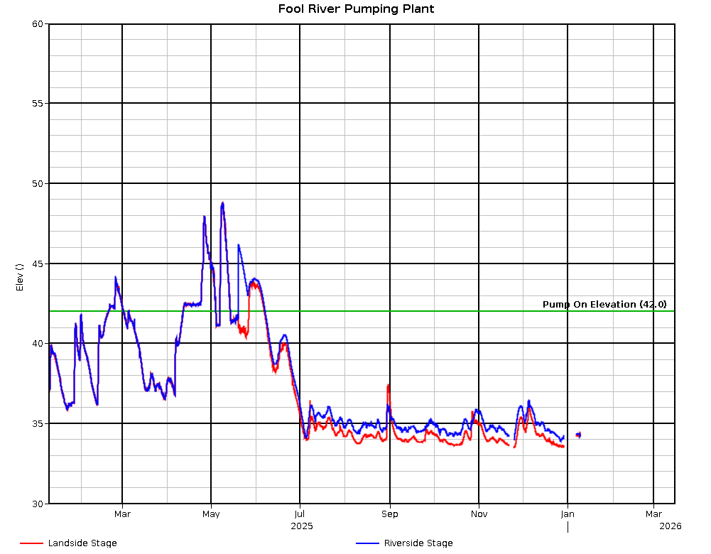
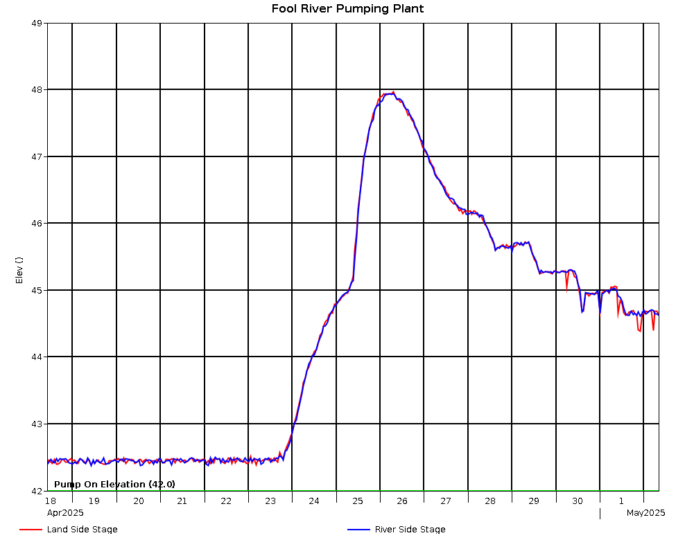
Fool River Pumping Plant L.S. |
4/26 @ 02:00 |
43.59 |
-.34 |
|
|
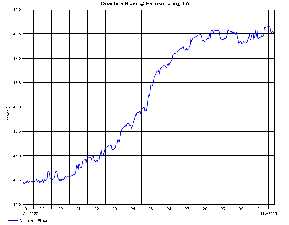
Ouachita River @ Harrisonburg, LA |
|
4/26 @ 03:00 |
47.18 |
47.18 |
-.31 |
|
|
Fool River Pumping Plant R.S. |
4/26 @ 02:00 |
45.71 |
-.29 |
|
|
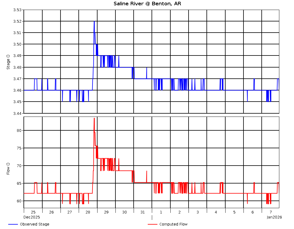
Saline River @ Benton, AR (USGS) |
18.0 |
4/26 @ 02:30 |
3.83 |
264.74 |
.02 |
227 |
|
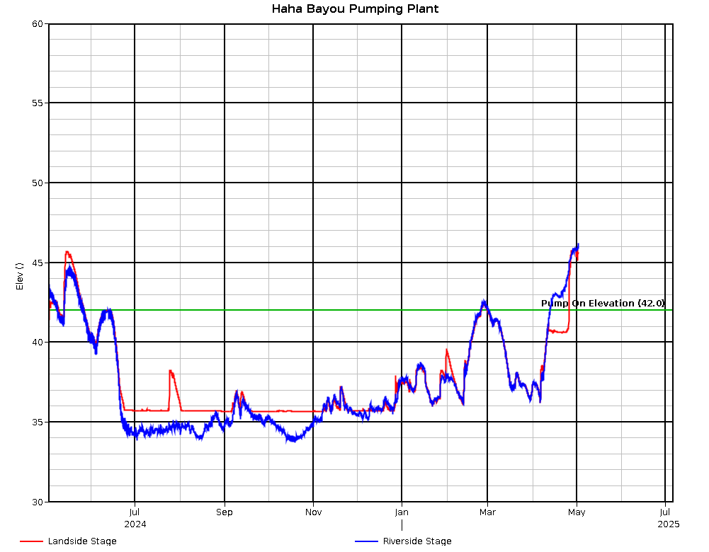
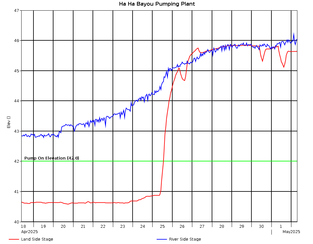
Ha Ha Bayou
Pumping Plant L.S. |
4/26 @ 02:00 |
42.29 |
-.23 |
|
|
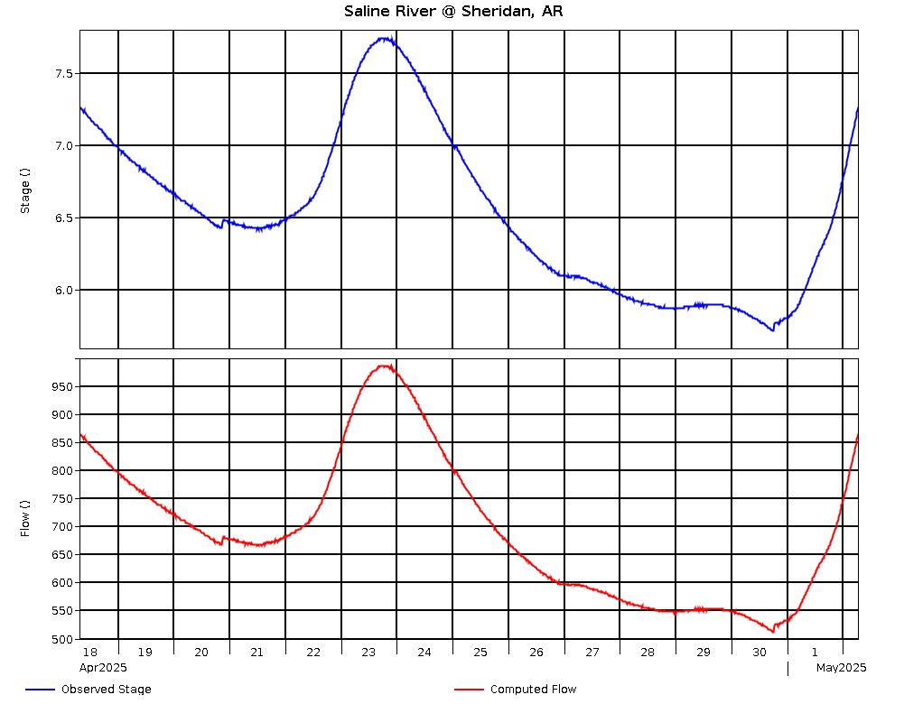
Saline River @ Sheridan, AR (USGS) |
14.0 |
4/26 @ 03:00 |
5.82 |
158.68 |
-.54 |
540 |
|
Ha Ha Bayou Pumping Plant R.S. |
4/26 @ 02:00 |
44.78 |
.09 |
|
|
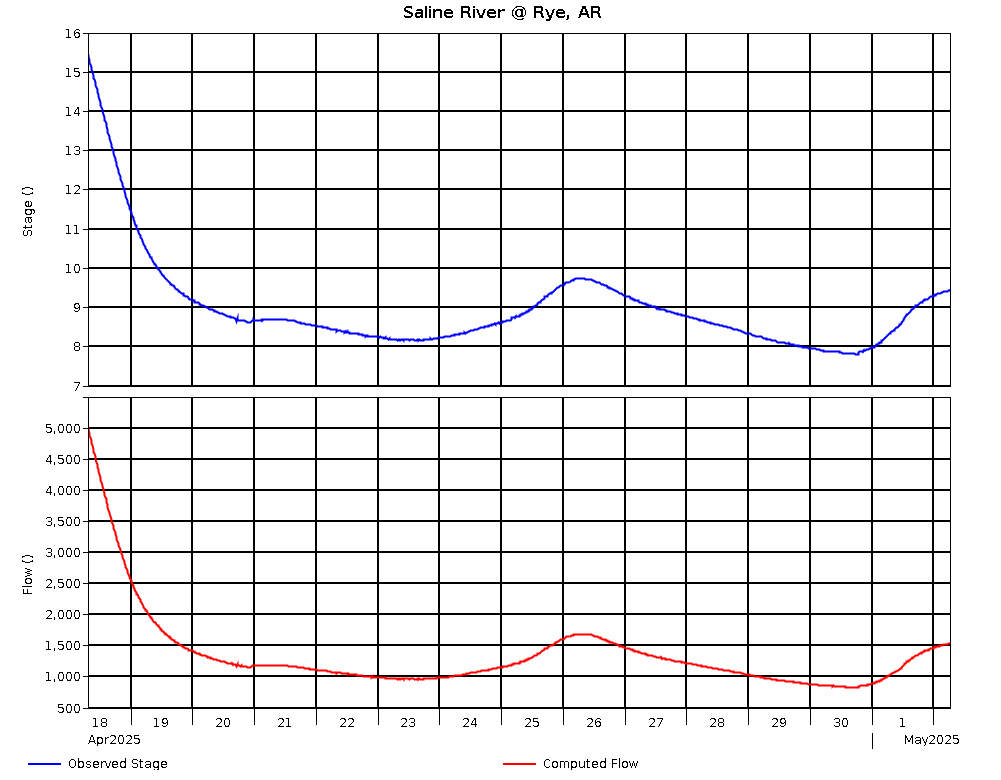
Saline River @ Rye, AR (USGS) |
26.0 |
4/26 @ 03:00 |
9.12 |
106.18 |
-.59 |
1,314 |
|
Long Branch Drainage Structure L.S. |
4/26 @ 02:00 |
41.06 |
-.44 |
|
|
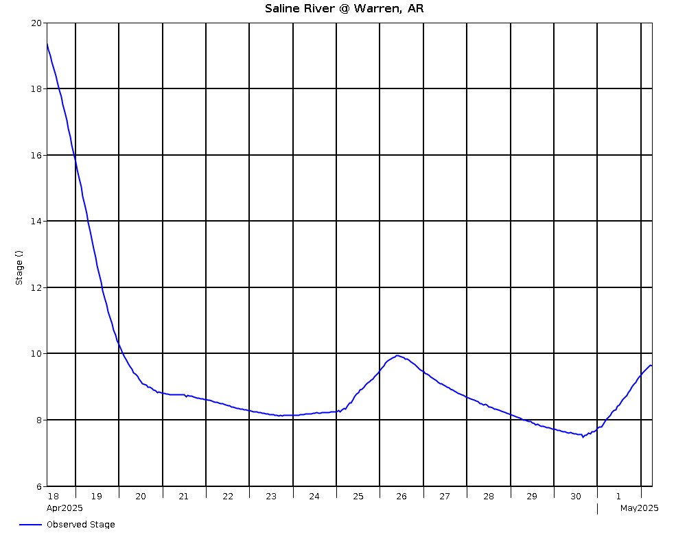
Saline River @ Warren, AR (USGS) |
16.0 |
4/26 @ 02:00 |
8.97 |
94.99 |
-.54 |
|
|
Long Branch Drainage Structure R.S. |
4/26 @ 02:00 |
39.11 |
-.53 |
|

